Traditionally, developers relied on finding areas suitable for power project siting and then looking through individual parcels in their areas of interest to identify the owners and county of the parcels. This process was time consuming and often overlooked the crucial aspect of contiguity among owners. As a result, navigating regulations and conducting outreach became needlessly complex, especially in areas involving multiple owners and counties.
Fortunately, there’s now a solution that addresses this challenge head-on. By integrating contiguity into the analysis, Enverus Power and Renewables Suitable Land Analytics Contiguous Acreage enhancement helps identify multiple parcels under the same ownership, simplifying negotiations and regulations needed to be followed, making the parcel outreach faster and bolstering overall project viability.
Finding Parcels for a Wind Power Project
Let’s explore how the parcel siting process for a wind project within a 2-mile radius of the planned transmission project OTTUMWA-SKUNK RIVER 345 KV TRANSMISSION LINE PROJECT unfolds with the Contiguous Acreage enhancement.
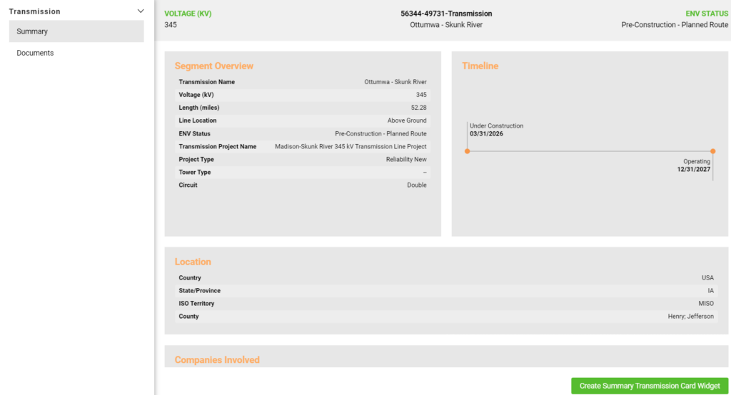
The OTTUMWA-SKUNK RIVER 345 KV TRANSMISSION LINE PROJECT represents a key component within the expansive MISO Long-Range Transmission Plan. In line with this strategic framework, the transmission line is set to be a collaborative effort between ITC Midwest and MidAmerican Energy, jointly owned to ensure effective management and operation. With ITC assuming the crucial role of overseeing the day-to-day operations and maintenance of the line, this project underscores a shared commitment to enhancing regional electric transmission infrastructure.
Within the radius, roughly 4,000 parcels need screening for wind potential. Previously, developers would assess parcel owners, average wind speeds and buildable acreage individually, which takes one month of two dedicated workers full time to pull this information. This process was laborious, often requiring investigation into neighboring parcels to gather additional data on wind potential, ownership and county regulations, and requires the full-time dedication of two employees for an entire month to compile the necessary information. Dealing with multiple owners or counties added complexity to negotiations and compliance efforts.
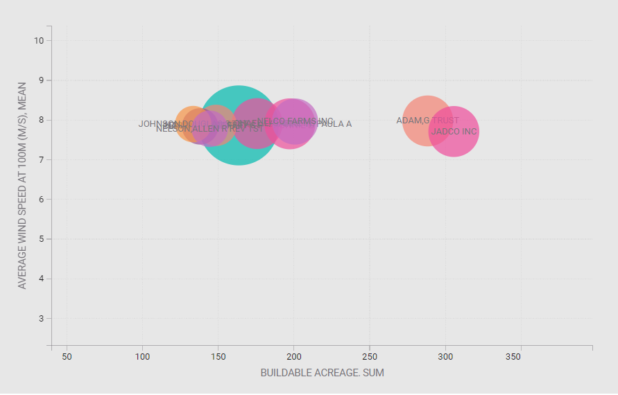
With Enverus PRISM® Power and Renewables Suitable Land Analytics, developers can gain insights into parcel ownership, buildable acreage and average wind speeds aggregated by the owner, facilitating more efficient analysis. Jadoc Inc. initially ranks first as the best combination of buildable acreage and wind resources. However, despite appearing promising the parcels are fragmented across different locations.
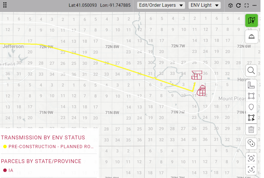
Leveraging Contiguous Acreage Enhancement
Here’s where Contiguous Acreage proves invaluable. By analyzing parcels based on contiguous ID, representing parcels grouped under the same ownership, developers can identify parcel owner and county groupings that are the most promising from a wind speed and buildable acreage perspective.
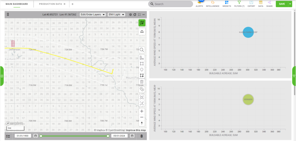
In this particular instance, the average wind speed at 100 m is 7.97 m/s, so the Kaska Farm Corp parcels from a wind speed, contiguity and buildable acreage perspective is more ideal for wind development compared to the Jadoc Inc. parcels identified previously.
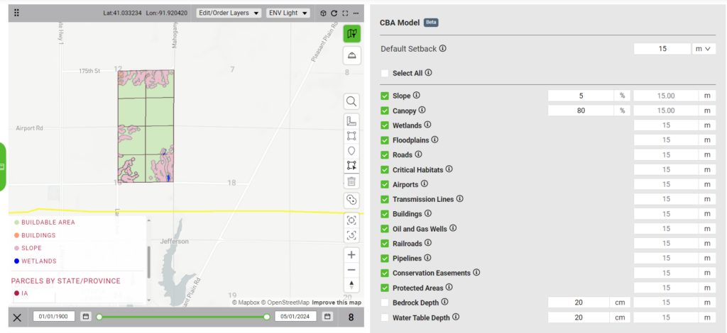
Moving forward, users can delve deeper into land buildability with Enverus Power and Renewables Suitable Land Analytics add-on, identifying potential environmental constraints with precision.
In conclusion, the integration of Contiguous Acreage into the parcel siting process represents a significant advancement in power project development. By shifting the focus from individual parcels to contiguous land groupings, developers can streamline the analysis, optimize resource utilization and enhance overall project viability. The ability to identify truly contiguous parcels not only simplifies negotiations and regulatory compliance but also maximizes the potential for efficient project execution.


